An Online History of the 17th Connecticut Volunteer Infantry during the U.S. Civil War
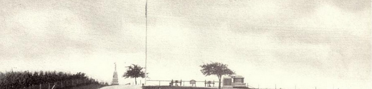
Emmitsburg to Gettysburg – Photo Tour of the 17th’s March
On June 30, 1863 the XI Corps was camped for the evening in and around the small Maryland town of Emmitsburg, about 9 miles south of Gettysburg. The three divisions on the corps stretched for some distance north of town. It is still possible today to retrace the route taken by the 17th on July 1, 1863 and still see some of the same things the soldiers saw on the way. Still, time marches on and there have been significant changes in the landscape as well. The area to the north of town where Barlow’s division was encamped is, for the most part, overtaken by modern development. One can still cross Middle Creek and Marsh Creek – only now you will do it over modern bridges.
These photos were taken in August 2012. In some cases, such as the area north of Gettysburg where the 17th marched out of town and to the far right of the Union line, it requires some imagination to picture open fields where many homes and businesses now stand. In other places little has changed.
As time goes on appropriate comments will be added from the accounts left by those who were there – some photos have them now, and all will have some once finished.
Clicking on the arrows will advance to the next photo or return to the previous photo, or you can just let the slideshow progress on its own.
View SE towards Emmitsburg
View N from North Seton Road
View NE from North Seton Road
N on Old Gettysburg Road leaving Emmitsburg
N on Old Gettysburg Road at PA border
Approach to Middle Creek
Moritz Tavern
View north from Moritz Tavern
Approaching Marsh Creek
Marsh Creek looking NW
Emmitsburg Road approaching Gettsyburg
Emmitsburg Road passing Round Tops
Passing Rose Farm
Approach to Sherfy and Klingle farms
Approaching Cordori farm
Emmitsburg Road near Bryan Farm
Emmitsburg Road to Baltimore St
Baltimore Street by Rupp
Baltimore Street approaching High Street
Baltimore Street approaching Middle Street
Carlisle Street crossing tracks
View towards site of Almshouse north of town
Area of Crawford house NE of town
1850s map of area
Crawford house NE of town
Area south of Stevens Run
1st position east of Harrisburg Road looking NE
1st position east of Harrisburg Road looking SW
2nd position west of Harrisburg Road looking N towards knoll
Route of 4 companies towards Rock Creek
Rock Creek
Benner Farm
Benner Farm looking south
Final position before knoll looking to knoll
Final position of the 17th prior to movement to knoll
Base of knoll looking north
Terrain passed on route to knoll
Route to final position
Knoll looking towards Blocher farm
Knoll looking towards Rock Creek and Benner Farm
Knoll looking towards Rock Creek and Benner Farm
17th position on Barlow's Knoll
Stratton Street retreat route
View towards Carlisle Street and lumberyard area
East Cemetery Hill towards Welty house
Cemetery Hill towards Welty house
Welty house south to Cemetery Hill
South towards Cemetery Hill position
1863 map section
17th monument from East Cemetery Hill
View from artillery position on East Cemetery Hill
Probable position of 17th CVI late afternoon July 2
Probable position of 17th CVI late afternoon, July 2
April,23,2013. I just want to say thank you so much for all these neat pictures and the story behind them.. my great great grandfather and his brother was in the H regiment of the 17th CVI.I would love some day to travel that area. Again thank you My grandfather name was Loren W. Britto & his brother was Frank Britto
Hi My name is Jennefer Miller. I just found this site after discovering several of my ancestors were in the 17th regiment CVI. And Donna we seem to have common relatives. My great-great-great grandfather was Slyvester Britto – who was wounded at the Battle of Gettysburg & died 3 days later. He was in Company F. One of his sons, Stephen Britto (Franks brother) was my grandmothers dad. Feel free to reach out if you want to share information on this branch of the family. So excited I came across this!
Hi Donna, it would seem that we are distantly related along my grandmother’s line. Her father was Joseph Britto. Loren and Frank Britto are recorded in my family’s genealogy.
Sue Curry
13 years ago
These photos are wonderful and so helpful in understanding better the march that the boys made over so many miles to get to their positions. I believe my ancestor, Capt. Wilson French, was wounded quite close to where Lt. Col. Fowler was killed. Wilson was helped into town to find a hospital to care for his wounded arm, but little help was available for him other than a doctor who quickly washed his wound but would not be seen again. This would be the only care he would receive since he refused amputation of the arm. Thank you for the exceptional work you have done on the website. I probably won’t be able to tour Gettysburg for many months, so these photos help me so much to virtually follow them on their way to battle. I must pop onto your website far more often. Thank you. Please feel free to email me back with any questions.
Susan Richardson Curry, Stratford, CT
Great-great granddaughter of Capt. Wilson French from Stratford, CT
Thanks for the nice words. I had done this route in 2003 as well and it would be interesting to post both sets just to see what had changed in the 9 years, never mind the 150 years. I’m hoping to get a similar set (but a little less detailed) for Chancellorsville that I took in 2008.
I hope you get the chance to spend some more time on the site!


The 11Pa,Ist Corp,2div. encamped on Wolfreds farm near Emmitsburg. Anyone know where that was?
April,23,2013. I just want to say thank you so much for all these neat pictures and the story behind them.. my great great grandfather and his brother was in the H regiment of the 17th CVI.I would love some day to travel that area. Again thank you My grandfather name was Loren W. Britto & his brother was Frank Britto
Hi My name is Jennefer Miller. I just found this site after discovering several of my ancestors were in the 17th regiment CVI. And Donna we seem to have common relatives. My great-great-great grandfather was Slyvester Britto – who was wounded at the Battle of Gettysburg & died 3 days later. He was in Company F. One of his sons, Stephen Britto (Franks brother) was my grandmothers dad. Feel free to reach out if you want to share information on this branch of the family. So excited I came across this!
Hi Donna, it would seem that we are distantly related along my grandmother’s line. Her father was Joseph Britto. Loren and Frank Britto are recorded in my family’s genealogy.
These photos are wonderful and so helpful in understanding better the march that the boys made over so many miles to get to their positions. I believe my ancestor, Capt. Wilson French, was wounded quite close to where Lt. Col. Fowler was killed. Wilson was helped into town to find a hospital to care for his wounded arm, but little help was available for him other than a doctor who quickly washed his wound but would not be seen again. This would be the only care he would receive since he refused amputation of the arm. Thank you for the exceptional work you have done on the website. I probably won’t be able to tour Gettysburg for many months, so these photos help me so much to virtually follow them on their way to battle. I must pop onto your website far more often. Thank you. Please feel free to email me back with any questions.
Susan Richardson Curry, Stratford, CT
Great-great granddaughter of Capt. Wilson French from Stratford, CT
Hi Sue –
Thanks for the nice words. I had done this route in 2003 as well and it would be interesting to post both sets just to see what had changed in the 9 years, never mind the 150 years. I’m hoping to get a similar set (but a little less detailed) for Chancellorsville that I took in 2008.
I hope you get the chance to spend some more time on the site!